Littlejohn
Big Creek, Pine Timber, Hardwood Bottoms
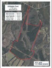
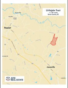
Littlejohn Tract is an outstanding rural property with great diversity for wildlife habitat and standing timber value, close to the conveniences of a big town. It lies on Littlejohn Road in a quiet area just east of the small town of Pacolet, about three miles from the Spartanburg County line.Mill Creek is a large stream with bottomlands of mature hardwoods and a big beaver swamp. Uplands are rolling hills covered by forests of tall, well-spaced, open pines. Steeper slopes overlook the creek bottom and nearby drainageways, shaded by big, mixed upland hardwoods. A large powerline right-of-way crosses the tract.
Wild turkeys are common and whitetail deer are abundant. About 140 acres are forested with loblolly pine planted in 2002. Another 22 acres near the south boundary were planted in 1997. All pine areas have been fertilized, thinned, and fertilized again. The 140 acres also had a hardwood control treatment after thinning leading to an open understory that is easy to see through and move through.
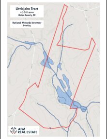
Close to the south bank of Mill Creek, the land is strongly rolling to steep. Red oak, white oak and American beech are common. On the north side of Mill Creek, upland slope transitions gently down into the wide bottomland. Yellow poplar, and sweetgum are dominant in the creek bottom along with maple and ash. Around 63 acres are covered by mature hardwood. About 5 acres are flooded between the main creek channel and steep slopes south of the creek. This area is a mix of dead timber, open water and wetland plants. Geese and ducks frequent this natural pond. Just over 20 acres of the tract are identified in the National Wetlands Inventory.
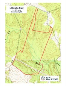
Access across the land is good with well over a mile of woods roads. No internal roads cross Mill Creek, but access comes from public roads on both sides. About six acres are maintained by Duke Power as a powerline right-of-way that is about 100 feet wide and a half mile long within the property. Some small openings of around a quarter acre are scattered along the roads. These are mostly sites used as logging decks. A small part of the bottomland has been kept open as a wildlife area.
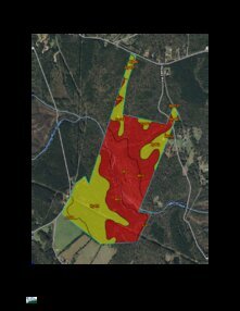
Soils are mostly sandy clay loam and are productive for timber and wildlife openings. Over much of the property, soils would be productive for larger openings and pastures if desired. Topography is gently rolling in many areas, but steeper along the transition between uplands and the creek bottom. A few large gullies are scattered across the tract.
The property has access from 3 public roads. The main gate is on Littlejohn Road with about 1,100 feet of road frontage. A powerline along the road is maintained by Broad River Electric. A natural gas line ends near the neighbor’s house across the road and fiber internet lines have been installed. There are no public waterlines nearby. A home would require well and septic. Soil maps indicate that septic perc potential is good for the most accessible parts of the property.
Another gate sits beside Tinsley Road with about 400 feet of frontage and a small electric distribution line. The third gate is near Jerusalem Road. This access crosses a neighbor’s land for about 100 feet between the property line and the public road. The immediate neighborhood is mostly wooded tracts mixed with pastures. Houses are widely scattered in the area with no planned subdivisions or commercial sites nearby. A couple of residences are within sight of the property along Littlejohn Road.
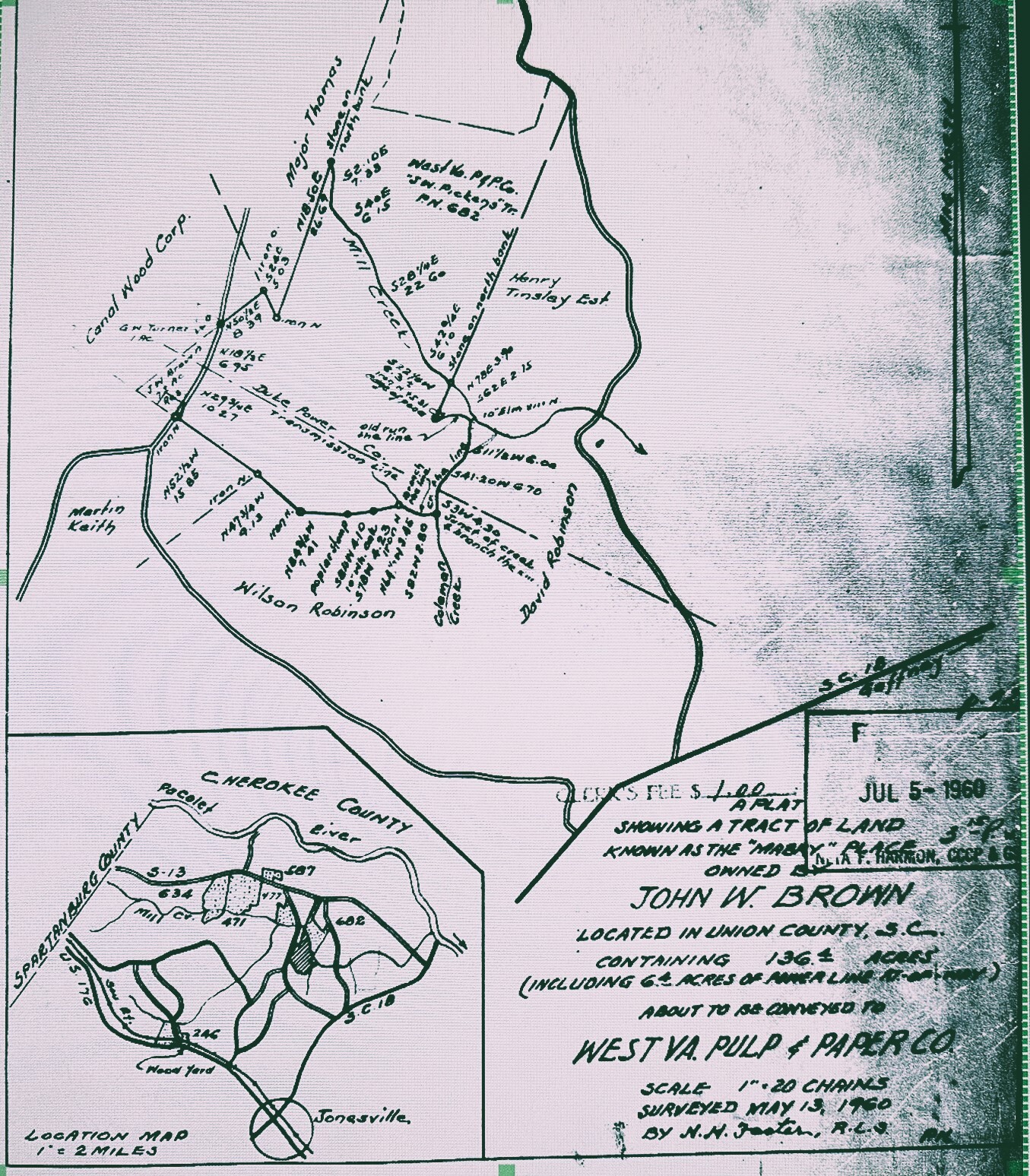
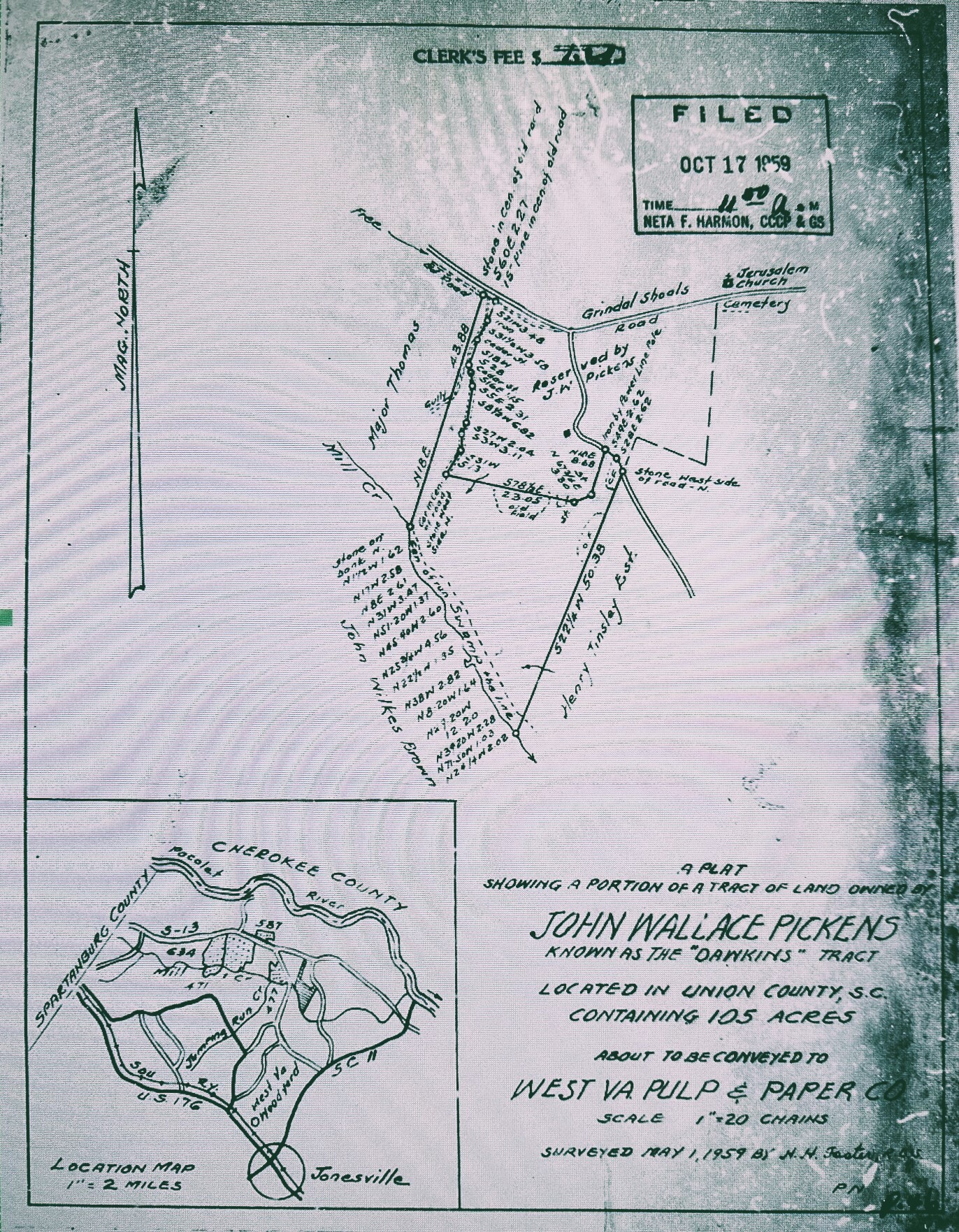
Two plats are recorded with the county which total 241 acres. The portion south of Mill Creek was surveyed in 1960 as 136.4 acres. The northern part is 105 acres surveyed in 1959. The property is timberland with no improvements and does not have an address. The main gate is on Littlejohn Road (GPS = “Littlejohn Rd, Jonesville, SC 29353”) about a quarter mile north of its junction with Robinson Farm Road. County tax map number is 009-00-00-003 000.
**There is an active hunt lease on this property. Please do not visit without first contacting the agent.
Spartanburg is about 25-minutes away and has everything from Aldi to Zaxby’s. There are local favorites like Beacon Drive-in, Carolina Barbecue and Wade’s southern comfort food, and big chains like Publix, Lowes, and Tractor Supply. Medical services are anchored by Spartanburg Medical Center, a regional research and teaching hospital. The tract is about 6 miles from Pacolet, 14 miles from Union, 17 miles from Spartanburg, and 48 miles from Greenville. All distances are approximate road miles to the center of town.